Before you head out on your adventures, please remember to check the Important Updates and Site Marker Post Status pages for any changes to hikes, directions, or parks. You can also check the Get Outdoors Adams! Facebook page for information.
NOTE: For an interactive map, please visit the Site Marker Hikes page and click on the blue "Locations Map" button. individual site marker pages also contain specific GPS coordinate locations.
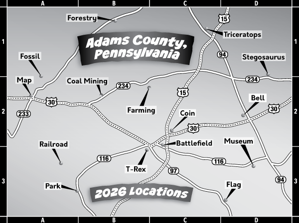
All directions were created starting from Lincoln Square in downtown Gettysburg. If traveling from a different area, please consult a map or other means to find starting points. Hours of operations are dawn to dusk unless otherwise noted or posted.
405 Boyer Nursery Road, Biglerville, PA 17307
Directions to Parking Area: Follow Chambersburg Street (Route 30) west for approximately 7.7 miles. Turn right onto Cashtown Road for 1.3 miles. Then turn left onto Boyer Nursery Road. The parking area at Boyer Nurseries will be to your right approximately 0.8 miles after turning on Boyer Nursery Road.
101 Pine Grove Road, PA Highway 233, Fayetteville, PA 17222
Directions to Parking Area: Follow Chambersburg Street (Route 30) west approximately 14.6 miles to Route 233. Turn right on Route 233 and then left into the park. Park at the parking area on the left , just past the main office building.
5685 Fairfield Road, Fairfield, PA 17320
Directions to Parking Area: Take Carlisle Street (Business Route 15) south. At the first stop light, turn right on Middle Street/Route 116 west and follow approximately 10.3 miles to the park on your right.
785 Berlin Road, New Oxford, PA 17350
Directions to Parking Area: Head east on US-30. At the next roundabout, take the 3rd exit onto Carlisle Street. Turn right onto Berlin Road. The parking area will be on your right.
1008 Hanover Road Gettysburg, PA 17325
Directions to Parking Area: Follow York Street (Route 30). In approximately 0.2 miles, stay to the right on PA 116-E/Hanover Road. After approximately 1.1 miles, turn left into Daniel Lady Farm. The parking area will be to the left of the entrance, in a grassy area in front of the soldier statues and near the barn.
North Avenue, East Berlin, PA 17316
Directions to Parking Area: Take York Street (Route 30) west approximately 2.3 miles to Route 15 North. Proceed north on Route 15 toward Harrisburg and exit at the East Berlin/Heidlersburg exit (Route 234). Turn right on Route 234 and continue about 8.3 miles into East Berlin. After crossing a bridge and entering East Berlin, take a left on Sixth St. Turn right on North Avenue and proceed to the park entrance on the left. Continue to the parking area.
545 Long Lane, Gettysburg, PA 17325
Directions to Parking Area: Follow Baltimore Street (Business Route 15) south approximately 0.3 miles to Breckenridge Street. Turn right on Breckenridge Street and continue 0.2 miles to Long Lane. Turn left on Long Lane and continue to Gettysburg Recreation Park on your right. Park in the first parking area located near the Charlie Sterner Recreation building.
110 Town Hill Road, York Springs, PA 17372
Directions to Parking Area: Take York Street (Route 30) approximately 2.2 miles to its intersections with US Route 15. Use the right lane to merge onto US-15 North and continue 12.45 miles to the York Springs exit (PA Route 94). Turn right on PA-94 North (Carlisle Street) toward York Springs. Continue 1.3 miles to Town Hill Road. Turn right on Town Hill Road and right again into the parking area.
151 E. Lakeview Drive, Littlestown, PA 17340
Directions to Parking Area: Head toward E. Zerfing Alley. Continue straight to stay on Baltimore Street. Continue onto Baltimore Pike. Continue onto N. Queen Street. Turn left onto E. Lakeview Drive. Turn right into the park and park in the spaces in front of the playground.
Directions to Beaver Trail: Head north on Baltimore St/Lincoln Square. At the traffic circle, take the 3rd exit onto Chambersburg Street. Turn right onto Buford Avenue. Continue onto US-30 W/Chambersburg Road. Turn right onto PA-233 N. Turn left onto Milesburn Road. Turn right onto Birch Run Road. Small parking area on your right just past the bridge.
2880 Table Rock Road, Biglerville, PA 17307
Directions to Parking Area: Follow Carlisle Street (Route 34) north approximately 6.5 miles to Biglerville. Turn right on East Hanover Street (Route 394) and continue as it changes to Table Rock Road. Remain on Table Rock Road (Route 394) about 0.9 miles to Oakside Community Park on the right. Park in the parking area across from the park office.
1100 Pine Grove Road, Gardners, PA 17324
Directions to Parking Area: Head east toward York Street. Exit the traffic circle onto PA-34 N/Carlisle Street/Lincoln Square. Continue to follow PA-34 N for about 10 miles. Turn slightly left onto S. Main Street and continue onto Bendersville Wenksville Road. Turn right onto Pine Grove Furnace Road. Continue past the Visitor’s Center to Fuller Lake Day Use Area parking.
50 Panther Drive, Hanover, PA 17331
Directions to Parking Area: Follow York Street (Route 30). In approximately 0.2 miles, stay to the right on PA 116-E/Hanover Road. Remain on PA 116 approximately 11.7 miles. Turn right onto S. 5th St. Turn right on Panther Drive and continue to the parking area on your right.
Directions to Parking Area: Follow York Street/US-30E for about 2.5 miles. At the second signal light after passing over Route 15, turn left on Smith Road. The park entrance will be about 0.25 miles on your left.
1537 Mount Hope Road, Fairfield, PA 17320
Directions to Parking Area: Take Baltimore Street (Business Route 15) south. At the first stop light, turn right onto Middle Street/Route 116 west and follow approximately 8 miles. Right after you see the big Strawberry Hill sign, turn right onto Bullfrog Road, which becomes Mount Hope Road. The parking area is on the left side of the road.
